Why Do I Need a Land Survey in Sydney?
Whether you’re planning to build, subdivide, or purchase property, understanding your exact land boundaries is essential. A professional land survey provides the legal and technical accuracy needed to make confident property decisions — especially in a city as diverse and fast-developing as Sydney.
In this article, we’ll explore what a land survey involves, when it’s required, and why it’s a crucial part of any property transaction or development project.
What Is a Land Survey?
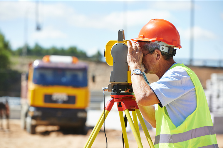
A land survey is a precise measurement and mapping of land boundaries, features, and elevations. It’s performed by a Registered Surveyor, licensed by the Board of Surveying and Spatial Information (BOSSI NSW).
Using specialised tools such as Total Stations, GPS, and drones, surveyors determine exact property lines, record terrain data, and prepare certified plans. These survey plans are legally recognised and are used for development approvals, title registration, and construction set-outs.
A professional survey doesn’t just measure — it verifies. It ensures your property aligns with official boundaries and complies with NSW legislation.
When Do You Need a Land Survey in Sydney?
There are many situations where engaging a surveyor is not only recommended but required. Here are the most common:
- Buying or Selling Property: A survey verifies the true boundary lines before settlement, helping avoid disputes or surprises later.
- Building a New Home or Extension: Ensures that structures are positioned within your legal boundaries and comply with council setbacks.
- Subdividing Land: Essential for creating new lots and registering them with NSW Land Registry Services.
- Fencing or Landscaping: Prevents encroachment on neighbouring land and ensures accurate fence placement.
- Lodging a Development Application (DA): Most Sydney councils require an up-to-date, certified survey plan as part of the submission process.
If you’re undertaking any of these projects, experienced land surveyors Sydney can help identify your precise property boundaries and prepare the necessary documentation to meet council and legal requirements.
See also: Sell Auto Parts and Accessories: Complete Guide to Growing Your Online Business
Types of Land Surveys
Different projects require different kinds of surveys. The main types include:
- Boundary Survey: Defines legal property limits and identifies corners or boundary markers.
- Detail & Contour Survey: Maps the surface features and elevations of your land for design and engineering work.
- Subdivision Survey: Divides land into multiple lots and prepares plans for council and title registration.
- Construction Set-Out Survey: Accurately marks the position of buildings, roads, and utilities according to approved plans.
- Identification Survey: Confirms if existing buildings or structures sit within the correct property boundaries.
Each type of survey serves a specific purpose but collectively ensures that every stage of property ownership or development is legally sound.
Local Factors That Make Land Surveys Important in Sydney
Sydney’s landscape and development conditions make professional surveys indispensable:
- Varied Terrain: From coastal suburbs to hilly areas, elevation changes can affect boundary accuracy and construction design.
- Older Properties: Many heritage and inner-city areas have outdated or incomplete boundary records.
- High-Density Development: With more subdivisions and smaller lots, precision is crucial for avoiding overlaps or encroachments.
- Council & State Requirements: Most Sydney councils and NSW Land Registry Services require certified surveys for approvals, subdivisions, or construction permits.
In short, accurate surveying protects both your investment and your compliance with Sydney’s building and planning regulations.
Benefits of Getting a Land Survey
Investing in a professional land survey offers multiple advantages:
- Prevents legal disputes with neighbours over boundary lines.
- Provides accurate data for architects, engineers, and builders.
- Ensures faster, smoother council approvals.
- Helps safeguard your property rights and resale value.
- Offers peace of mind before major financial decisions.
A survey is more than paperwork — it’s the foundation of every responsible property project.
Why You Should Choose a Registered Surveyor
Only Registered Surveyors, accredited under BOSSI NSW, can legally certify cadastral (boundary) surveys. Choosing a qualified and experienced professional ensures compliance with NSW regulations and eliminates the risk of inaccurate or invalid survey results.
Local knowledge also matters. A Sydney-based surveyor understands the city’s terrain, council processes, and land-use regulations — saving you time and money throughout your project.
Frequently Asked Questions
How much does a land survey cost in Sydney?
Typical residential surveys start from around $800–$1,500, depending on property size, terrain, and complexity.
How long does it take?
Most residential surveys can be completed within 1–3 days, while larger developments may take longer for certification and drafting.
Do I need a survey for fencing or renovations?
Yes. Even minor projects benefit from confirming exact boundaries to prevent disputes or non-compliance.
Key Takeaways
A land survey isn’t just a technical step — it’s a vital safeguard for property owners in Sydney. Whether you’re buying, subdividing, or developing, accurate measurements ensure your project starts on solid ground.
For reliable, compliant, and high-precision results, work with registered professionals who understand Sydney’s property landscape and regulations.
CitiSurv’s team of experienced land surveyors provides trusted surveying solutions across Sydney and New South Wales — helping you build, buy, or subdivide with confidence.